Tungnath, Chopta, Uttarakhand.

Legend
According to Hindu mythology Lord Shiva and his consort Parvati both reside in the Himalayas: Lord Shiva resides at Mount Kailash. Parvati is also called Shail Putri which means 'daughter of hills'.
The Tunganath is indelibly linked to the origin of the Panch Kedar temples built by the Pandavas. The legend states that sage Vyas Rishi advised the Pandavas that since they were culpable of slaying their own relatives (Kauravas, their cousins) during the Mahabharata war or Kurukshetra war, their act could be pardoned only by Lord Shiva. Consequently, the Pandavas went in search of Shiva who was avoiding them since he was convinced of the guilt of Pandavas. In order to keep away from them, Shiva took the form of a bull and went into hiding in an underground safe haven at Guptakashi, where Pandavas chased him. But later Shiva’s body in the form of bull’s body parts rematerialized at five different locations that represent the "Panch Kedar" where Pandavas built temples of Lord Shiva at each location, to worship and venerate, seeking his pardon and blessings. Each one is identified with a part of his body; Tungnath is identified as the place where the bahu (hands) were seen: hump was seen at Kedarnath; head appeared at Rudranath; his navel and stomach surfaced at Madhyamaheshwar; and his jata (hair or locks) at Kalpeshwar.
Legend also states that Lord Rama, the chief icon of the Ramayana epic, meditated at the Chandrashila peak, which is close to Tungnath. It is also said that Ravana did penance to Shiva, the lord of the peaks, when he resided here.
Worship
The priest at this temple is a local Brahmin from ukhimath village, unlike the other Kedar temples where the priests are from South India, a tradition set by the eighth century Hindu seer Sankaracharya. It is also said that the Maithani Brahmins officiate as priests at this temple. During the winter season, the temple is closed and the symbolic image of the deity and the temple priests are moved to Mukkumath, which is 19 km (12 mi) from here. It is near Duggalbitha 10 km (6 mi) before Chopta towards Ukhimath.
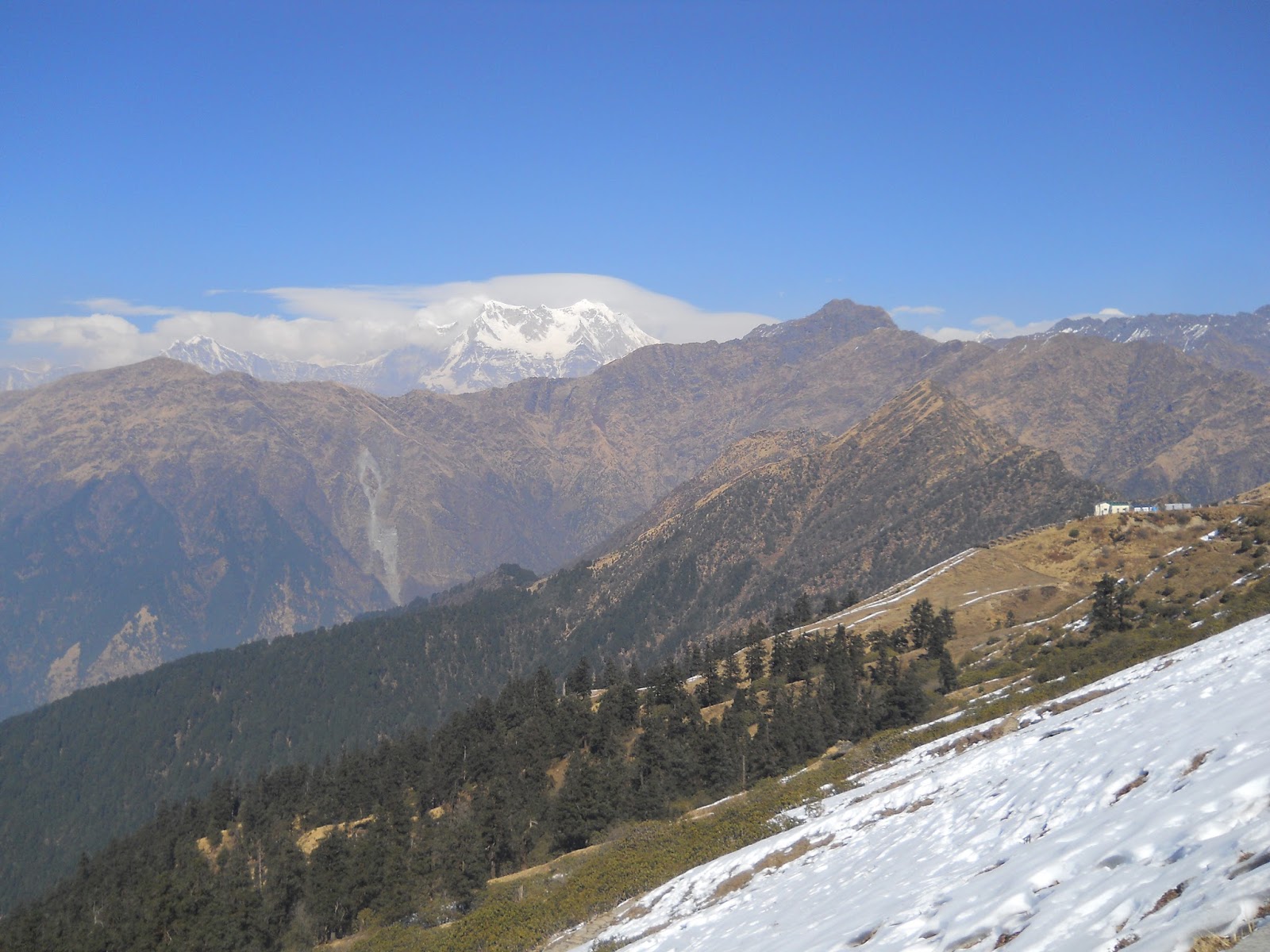
Geography
Tungnath is at the top of the ridge dividing the waters of the Mandakini River (raising from Kedarnath) from those of the Alaknanda River (raising above Badrinath). The Tungnath peak on this ridge is the source of three springs, which form the Akashkamini River. The temple lies about 2 km (1.2 mi) below the Chandrashila Peak (4,000 m (13,123 ft)). The road to Chopta is just below this ridge and hence provides the shortest bridle approach path for trekking to the temple from Chopta, over a short distance of about 4 km (2.5 mi). From the top of the Chandrashila peak, picturseque views of the Himalayan range comprising snow peaks of Nanda Devi, Panch Chuli, Banderpoonch, Kedarnath, Chaukhamba and Neelkanth on one side, and the Garhwal valley on the opposite side could be witnessed. The valley between Chopta and Tunganath temple has wooded hills with rich alpine meadows with rhododendron coppices and also agricultural fields. The rhododendrons, when they are in full bloom during March, display dazzling colours ranging from crimson to pink. A high-altitude botanical station of the Garhwal University is located here. Nearing the top of the temple, there is a forest resthouse at Dugalibitta, just opposite to the Kedarnath range of hills. The Kedaranth Wild Life Sanctuary, also called the Kedarnath Musk Deer Sanctuary, set up in 1972 to preserve the endangered musk deer, which lies in the region, also has a musk deer breeding centre at Kharchula Kharak near Chopta.
Trekking and access
Other than being a religious destination, Tungnath is also a well known trekking destination. The 4 km (2.5 mi) trek starts from Chopta (9,600 ft (2,926 m)), the nearest place on the NH 58. Chopta is 63 km (39 mi) from Rudraprayag towards Karnaprayag and is reached from Rishikesh via Devprayag, Srinagar and Rudraprayag.
Of all the Panch Kedar trek routes, the route to Tungnath is the shortest: only 4 km (2.5 mi) from Chopta (on the Ukhimath Gopeshwar road) that can be covered in approximately 3–4 hours (depending on the trekker's physical ability). Trek is a moderate (and sometimes steep) climb (9,600–12,000 ft (2,926–3,658 m)), the trek path is stone paved with benches provided en route at intervals to rest and enjoy the beautiful views of the Chowkhamba, Nanda Devi, Neelkanth and Kedarnath peaks.[10]Generally, the pilgrimage to Tunganath is undertaken as part of the Panch Kedar trekking covering all five temples over a 170 km (105.6 mi) route (road cum trek length) starting from Rishikesh in the order of: Kedarnath, Tungnath, Rudranath, Madhyamaheswar and Kalpeshwar. The few pilgrims who undertake this trekking pilgrimage to the shrine do so in summer months (end April or early May to October) as the temple remains snow bound and unapproachable. During this period even Chopta, the nearest road head remains deserted. But it is said that few adepts come to the area during the winter avoiding the pilgrims. The climb to Chandarshila is for 2 km (1.2 mi).
The nearest airport is Jolly Grant, Dehradun (258 km (160 mi)). The nearest railway station is at Rishikesh (241 km (150 mi)).
Gallery


Data Source :- Wikipedia


Comments
Post a Comment